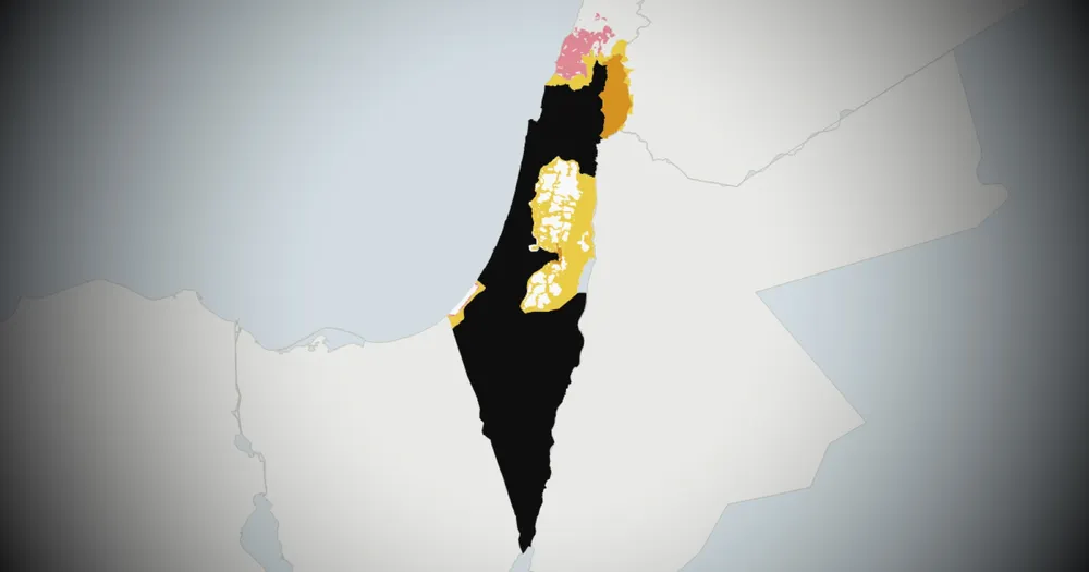
Israel's territory inside the 1949 armistice lines covers about 20,600 square kilometres. Beyond those lines, its forces and administration control 5,777 square kilometres more, in four places. That is 28 per cent on top of the state itself.
Crust News built the following maps from published data: the Israeli military's own maps, UN security and humanitarian layers, and records kept by Peace Now, the Institute for the Study of War and researchers at the American University of Beirut. Every figure below is our measurement of that data.