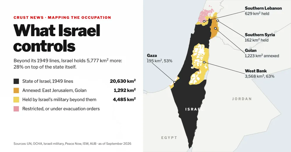
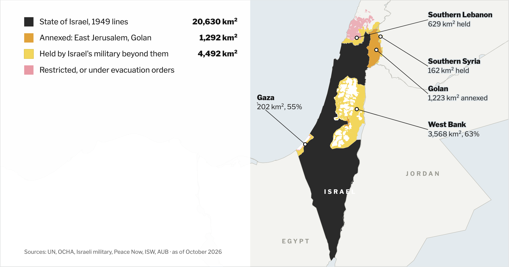
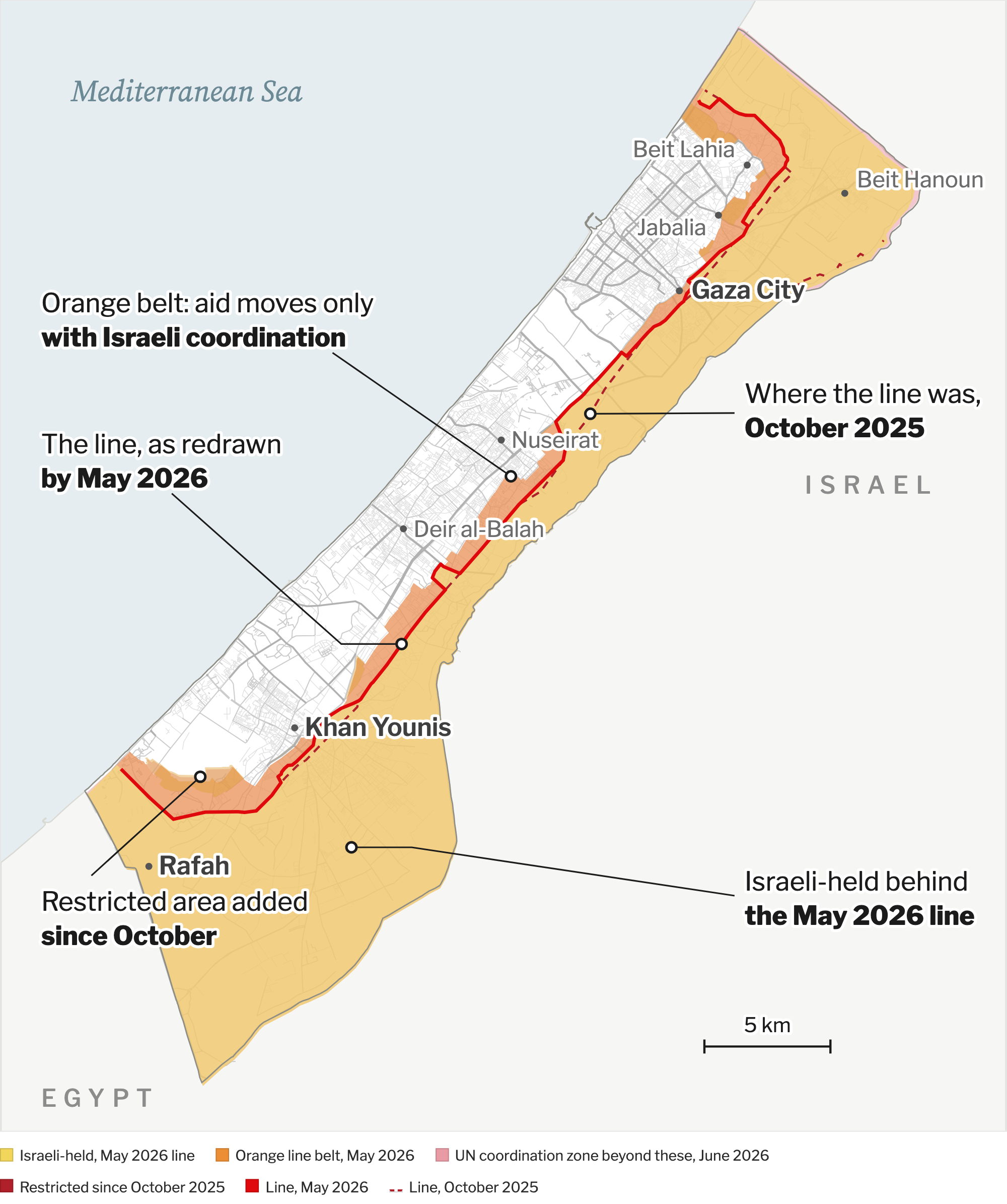
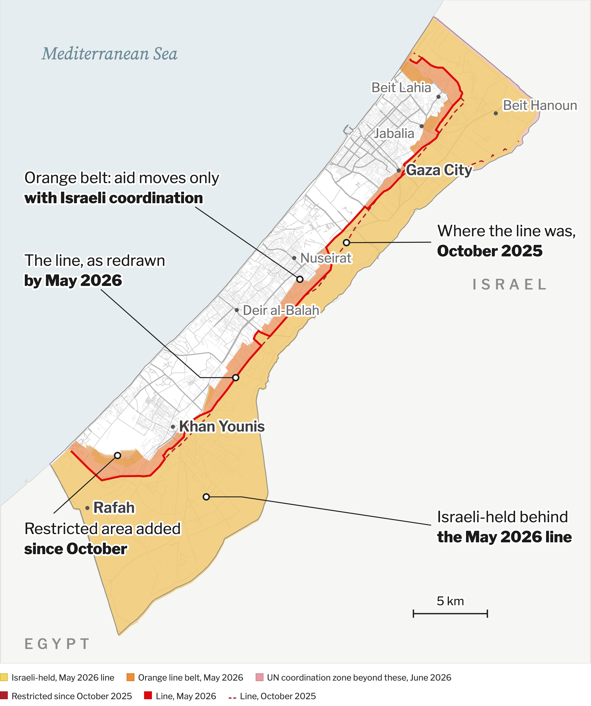
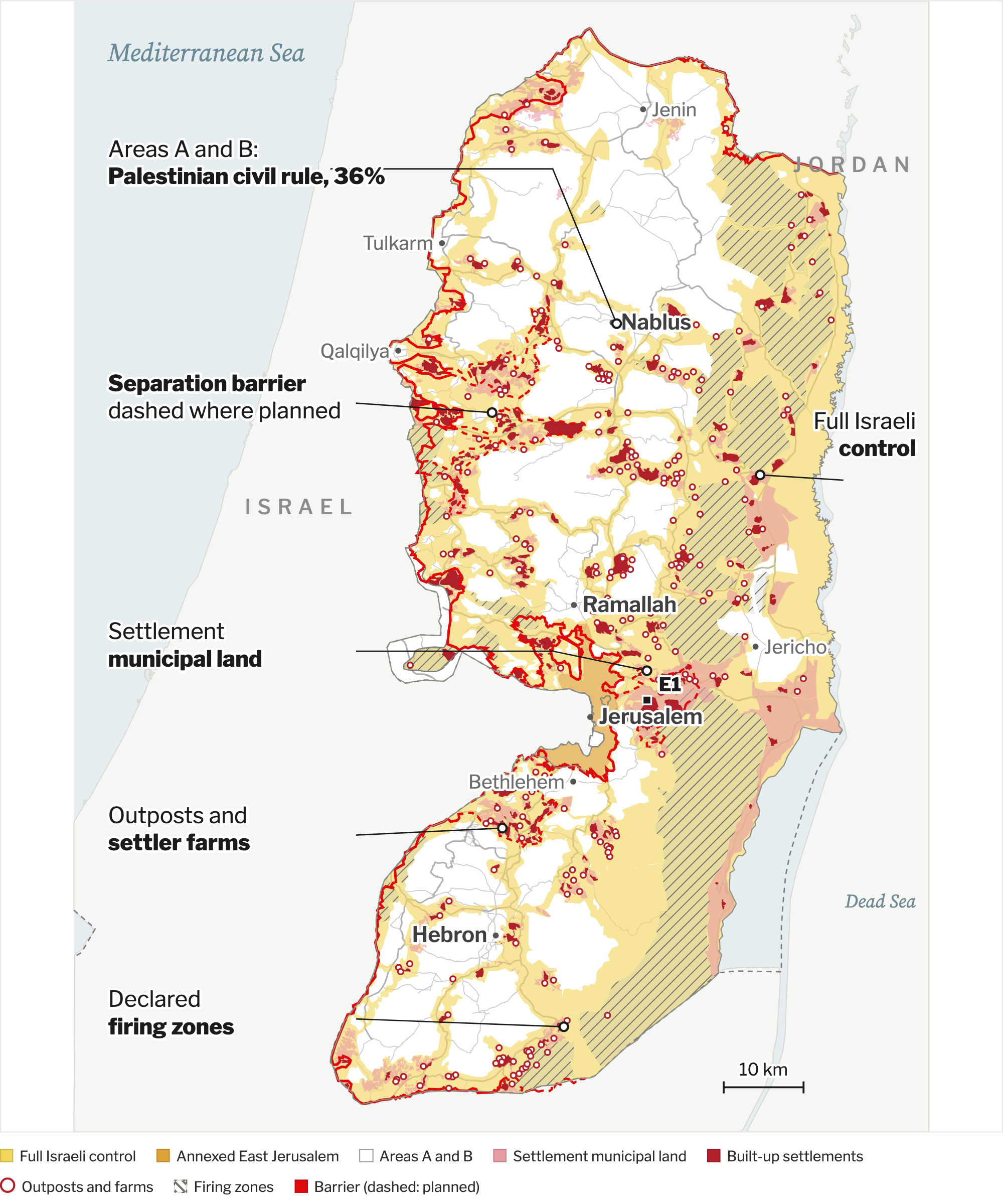
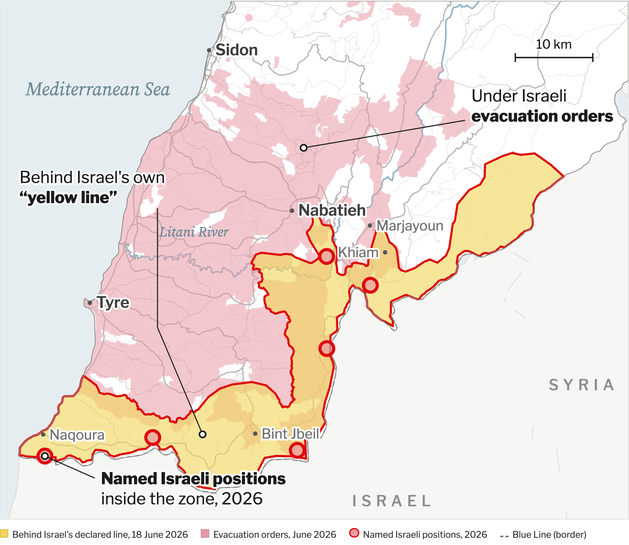
Maps of the ground Israel holds or runs beyond its 1949 lines, in Gaza, the West Bank, southern Lebanon and southern Syria, built from UN, Israeli military and independent data. Free to download.
Last updated 15 October 2026. These maps show the ground Israel holds or runs beyond its 1949 armistice lines: in Gaza, the West Bank, southern Lebanon and southern Syria. Every shape comes from a published layer, credited under each map. The full write-up, with every figure, follows.
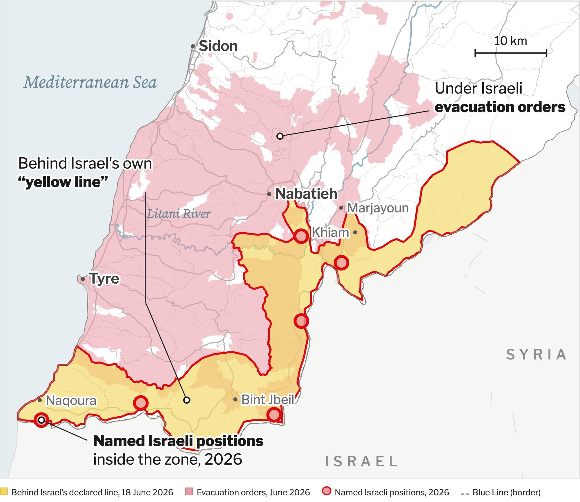
Sources: Israeli military "yellow line" of 18 June 2026 as traced by GISINSS; evacuation orders mapped by researchers at the American University of Beirut; named Israeli positions from GISINSS (June 2026) and AUB (March 2026). No newer line has been published; the New York Times counted 48 of about 60 villages inside the zone levelled by 12 October 2026.